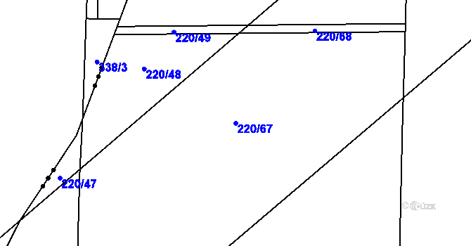
Parcela st. 220/67 v KÚ Kunětice - katastr nemovitostí
Nahlížení do katastru nemovitostí, parcela st. 220/67 v KÚ Kunětice o výměře 3659m², trvalý travní porost.| Katastrální území | |
|---|---|
| Obec | Kunětice |
| KÚ | Kunětice |

| Parcela st. 220/67 v KÚ Kunětice Informace z katastru nemovitostí |
|
|---|---|
| Kmenové číslo/poddělení | 220/67 |
| Výměra parcely | 3659m² |
| Stavební objekty na parcele | - |
| Více o parcele | Nahlížení - majitel | CUZK |
| Druh číslování | Pozemkové |
| Druh pozemku | trvalý travní porost |
| Způsob využití | |
| Platí od | 26.06.2003 |
| Způsob ochrany pozemku |
jiná ochrana pozemku zemědělský půdní fond |
| Bonita pozemku | BPEJ | Výměra [m²] |
| 35700 | 3659 |
| ID parcely | PA.2822327606 |
| Definiční bod | X:-1057823.56 Y:-644370.66 |
|---|---|
| GPS pozice | 50.06790615649555,15.811753606982979 |
| Mapy: Katastrální mapa | Marushka | Seznam | Google | |
Katastrální mapa
Objekty a parcely s číslem 220 v KÚ Kunětice
Jiné objekty nebo parcely s domovním číslem objektu nebo kmenovým číslem parcely 220 v KÚ Kunětice jsou v následující tabulce.| Adresa, objekt nebo parcela | Plocha | KÚ | Obec |
|---|---|---|---|
| Parcela 220/1 | 9311 | Kunětice | Kunětice |
| Parcela 220/10 | 984 | Kunětice | Kunětice |
| Parcela 220/11 | 2971 | Kunětice | Kunětice |
| Parcela 220/12 | 5152 | Kunětice | Kunětice |
| Parcela 220/2 | 2196 | Kunětice | Kunětice |
| Parcela 220/3 | 13604 | Kunětice | Kunětice |
| Parcela 220/4 | 2503 | Kunětice | Kunětice |
| Parcela 220/43 | 148 | Kunětice | Kunětice |
| Parcela 220/44 | 69 | Kunětice | Kunětice |
| Parcela 220/45 | 100 | Kunětice | Kunětice |
| Parcela 220/46 | 25 | Kunětice | Kunětice |
| Parcela 220/47 | 82 | Kunětice | Kunětice |
| Parcela 220/48 | 598 | Kunětice | Kunětice |
| Parcela 220/49 | 68 | Kunětice | Kunětice |
| Parcela 220/5 | 262 | Kunětice | Kunětice |
| Parcela 220/6 | 532 | Kunětice | Kunětice |
| Parcela 220/7 | 228 | Kunětice | Kunětice |
| Parcela 220/8 | 108 | Kunětice | Kunětice |
| Parcela 220/9 | 67 | Kunětice | Kunětice |
| Parcela st.220/1 | 131 | Kunětice | Kunětice |

